
English| EUR
Suggested for you
More currencies
Choose a language
The journey from Inverness to John O'Groats covers 113 miles of Scotland's dramatic northern coastline. Understanding the distance and route options helps you plan timing, stops, and the logistics that make this iconic trip work. This guide answers the core question and frames what lies between the Highland capital and Britain's northeastern corner.
Quick answer
The distance from Inverness to John O'Groats is 113 miles (182 kilometers) by road via the A9 and A99. Most drivers complete the journey in 2 hours 30 minutes to 3 hours under normal conditions. The route follows the eastern coast through Caithness, passing towns like Wick. Public transport options exist but require longer travel times, typically 3 to 4 hours with connections.
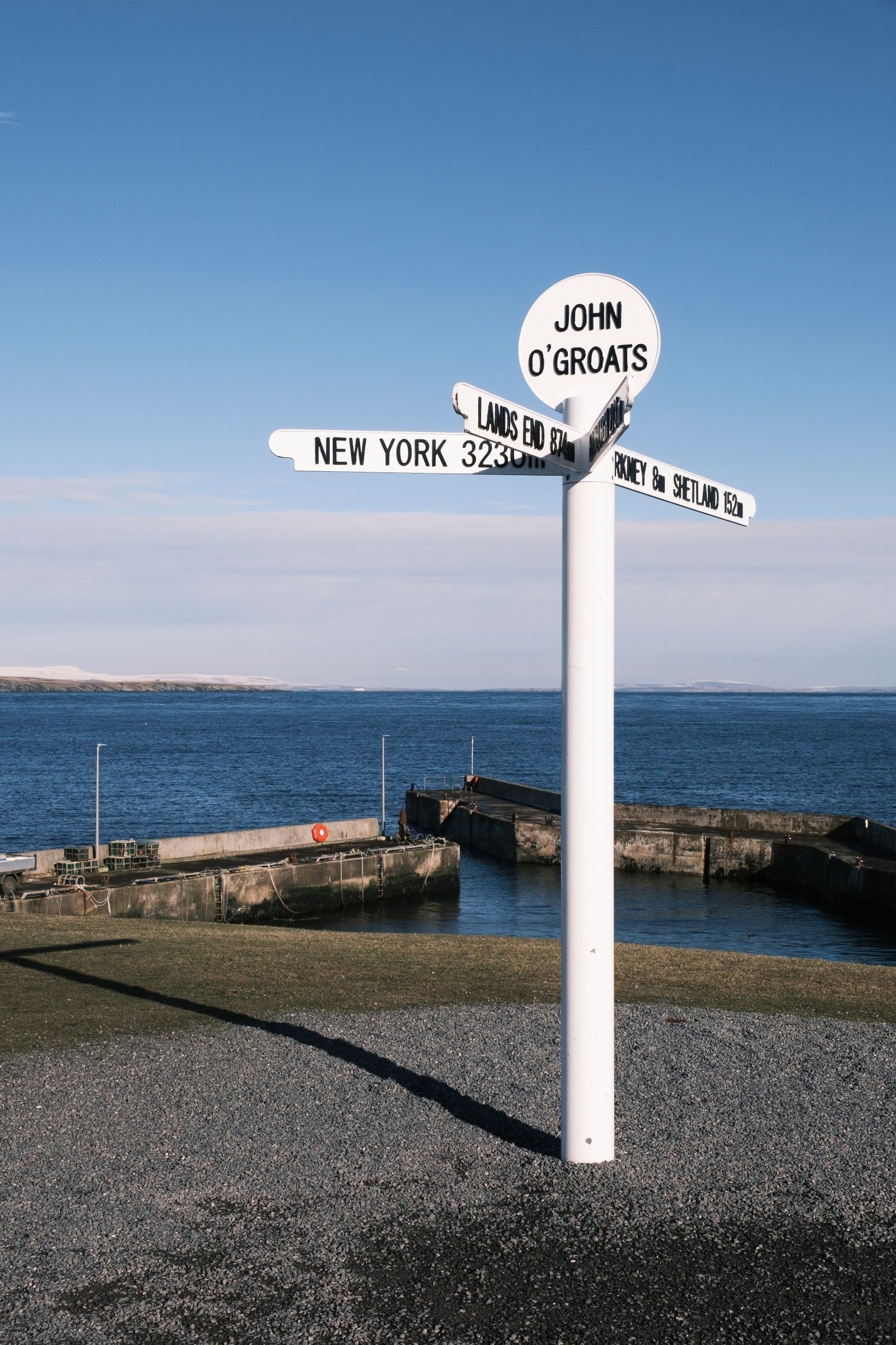
The 113-mile stretch between Inverness and John O'Groats represents one of the most geographically significant journeys in Britain, linking the Highlands' administrative heart to the landmass's northeastern extremity. The route threads through Caithness, a region where geological age meets climatic severity—flat peatlands give way to cliffs shaped by North Sea storms, and settlement density drops sharply beyond Helmsdale. The A9 carries the bulk of the route, running north from Inverness along the Moray and Dornoch Firths before cutting inland through Caithness. At Latheron, the A99 branches east toward Wick, then continues to John O'Groats. The road is single carriageway for most of its length, with passing places in rural sections. Traffic volumes thin dramatically after Dornoch, and fuel stations become sparse beyond Brora. The drive covers varied terrain: forested glens near Inverness, coastal stretches past Golspie, and the treeless expanse of Caithness, where wind turbines punctuate the skyline. Timing the Inverness to John O'Groats distance depends on season and intent. Summer daylight extends to near-midnight, allowing flexible departure times and unhurried exploration. Winter conditions demand earlier starts—daylight shrinks to six hours, and road surfaces ice over in exposed sections. The route's appeal lies not in speed but in transition: from Highland massifs to Arctic-edge flatlands, from dense settlement to a coastline where human presence feels negotiated rather than assured. The journey's endpoint, John O'Groats, functions as both literal destination and symbolic marker. Its signpost—listing distances to global cities—has anchored countless photographs since the 1950s. The site itself offers little infrastructure beyond a café, gift shop, and harbor, but the coastal position delivers unobstructed views toward Orkney and Duncansby Head. Arriving here completes a transect across northern Scotland, a passage that compresses centuries of clan history, industrial decline, and renewable energy investment into a single road. The distance from Inverness to John O'Groats is measurable in miles, but the journey's substance lies in what those miles traverse.
“The 113-mile route compresses centuries of clan history, industrial decline, and renewable energy investment into a single road.”
John o' Groats is located in the far northeast of Scotland, approximately 120 miles from Inverness. The primary route for motorists follows the A9 north to Latheron before continuing on the A99.
A9 and A99 via Wick
ScotRail line to Wick Station
Stagecoach X99 from Inverness to Wick then local bus
The address is John o' Groats, Wick KW1 4YR, United Kingdom. Plan your journey to arrive between 08:00–18:00 to ensure the best daylight for photographing the iconic signpost and coastal views.
Travelers moving between Inverness and John o'Groats must choose between the flexibility of personal transport and the structured convenience of public transit services. This comparison evaluates the logistics of driving against regional bus and rail alternatives.
| Driving Bus & Train | Personal Vehicle Stagecoach & ScotRail Recommended | |
|---|---|---|
| Route Options | Direct road routes | Bus to Wick/Thurso plus taxi |
| Average Travel Time | 3 hours | 5 to 6 hours |
| Typical Cost | 45 GBP | 35 GBP |
| Scenery Quality | Coastal and rural | Coastal and rural |
| Suitability | Flexible schedules | Budget-conscious travelers |
Verdict: Choose personal transport for maximum efficiency, or opt for public transit if you prefer to avoid the responsibility of driving on rural northern roads.
This road trip itinerary suits drivers with a full day available, covering the 110-mile journey in approximately 6–7 hours including stops. The route follows the A9 north then joins the A99 coastal road.
Leave early to maximize daylight at stopovers. The A9 climbs inland through Sutherland with moorland and mountain views for the first 60 miles.
Explore the château-style castle and formal gardens for 60–90 minutes; entry fee applies. The clifftop location offers sea views toward the Moray Firth.
Stop in this fishing village for lunch at a harbourside café. The Timespan Museum covers local herring and gold-rush history if time allows.
Pause at Wick harbour or visit the ruins of Castle Sinclair Girnigoe perched on cliff edges. Allow 30 minutes for photos and a leg stretch.
Reach the signpost by late afternoon when light is optimal for photographs. The site is free to visit and open around the clock.
The period between May and September provides the most practical window for the journey due to extended daylight hours. These months offer safer road conditions, whereas winter travel frequently involves early darkness and unpredictable weather.
Mild temperatures 12°C–17°C
Long daylight hours allow for safer driving and easier navigation. This period facilitates consistent access to the route.
Cold, frequent rain, 2°C–8°C
Winter driving conditions require caution due to ice and limited daylight. Many services operate on reduced schedules.
—
This daily window provides the best daylight for photographing the iconic signpost and coastal views.
Verdict: The best time to travel is between May and September, ideally arriving between 08:00 and 18:00 to maximize visibility.
The popularity of John o' Groats as a landmark often leads to misunderstandings regarding its geographical status. Clarifying these points ensures visitors have accurate expectations for their trip.
MythJohn o' Groats is the northernmost point of mainland Britain
FactDunnet Head is the true northernmost point of the British mainland, located several miles west.
MythYou must pay to access the John o' Groats site
FactEntry to the area is 0 GBP (Free entry).
MythThe site has restricted operating hours
FactThe site at John o' Groats, Wick KW1 4YR, United Kingdom is open 00:00–23:59 every day.
The 110-mile journey from Inverness to John o'Groats is straightforward but leaves little room for error. Two planning gaps catch most visitors off guard.
Assuming there is a train station at John o'Groats
The railway terminates at Thurso or Wick — both 17 miles short of the endpoint. Book onward bus connections through Stagecoach or arrange a taxi in advance to avoid being stranded.
Running low on fuel between Helmsdale and Thurso
Petrol stations become sparse north of Helmsdale, with gaps of 25+ miles. Fill your tank at Helmsdale or Latheron to avoid anxiety on the final stretch.
Underestimating the round-trip time for same-day visits
The return journey doubles your driving to 220 miles, plus stops. Budget at least six hours total or plan an overnight stay in Thurso to avoid fatigue.
Relying solely on mobile data for navigation in remote sections
Signal drops entirely in stretches beyond Lybster. Download offline maps before leaving Inverness and carry a paper backup for the coastal route.
Follow these practical suggestions to navigate the northern roads safely and efficiently during your journey from Inverness.
The A9 features frequent average speed cameras that monitor your velocity over long segments. Maintain a steady pace within the limit rather than braking repeatedly to avoid penalties.
Single-track roads in the Highlands rely on passing places to allow vehicles to move in opposite directions. Pull into the left-hand side or wait opposite the passing place on the right to let oncoming traffic safely pass.
Cellular service is inconsistent in remote sections between Inverness and the coast. Download offline maps via your preferred navigation app before departure to ensure uninterrupted routing.
If a local driver is traveling behind you at a faster pace, use the next available passing place to let them overtake. This practice maintains smooth traffic flow and reduces frustration for other road users.
Deer and livestock often cross rural roads unexpectedly throughout the day. Keep your speed controlled, especially at dawn and dusk, to allow for increased reaction time.
Everything you need to know about distance from inverness to john o'groats
The distance from inverness to john o'groats is approximately 110 to 125 miles depending on your chosen route along the A9 and A99. Planning your drive in advance helps ensure a smooth journey across the Highlands.
Travel time for a typical Inverness to John O'Groats tour varies based on stops, but driving directly usually takes about 3 hours. Please check our itinerary section for recommended sightseeing breaks along the route.
There is 0 GBP entrance fee for the site, making it a free attraction for all visitors. The area is maintained for public access throughout the year.
The best arrival window is 08:00–18:00 to ensure optimal daylight for photographing the iconic signpost and coastal views. Visiting during these hours provides the clearest conditions for your pictures.
The site is open daily from Monday to Sunday, 00:00–23:59. This accessibility allows you to plan your arrival around the best weather and daylight conditions.
While the precise distance from inverness to john o'groats varies by the exact starting point, most travelers cover the distance in a few hours of driving. You can refer to our logistics section for detailed mapping of the journey.
The drive is well-suited for families as it offers scenic views and accessible coastal walks upon arrival. We recommend checking our booking pages to coordinate your travel plans efficiently.